
CFS Alsask
Spread throughout much of the Canadian prairies lay old and abandoned military sites, each with a unique story that, at one point in time, influenced and shaped communities in significant ways. Hidden near the junction of Highway #7 and Highway #44, along the Alberta-Saskatchewan border, remains one of these lost stories – a vestige of a distant memory, a symbol of Canada’s Cold War legacy, the remnants of Canadian Forces Station (CFS) Alsask.
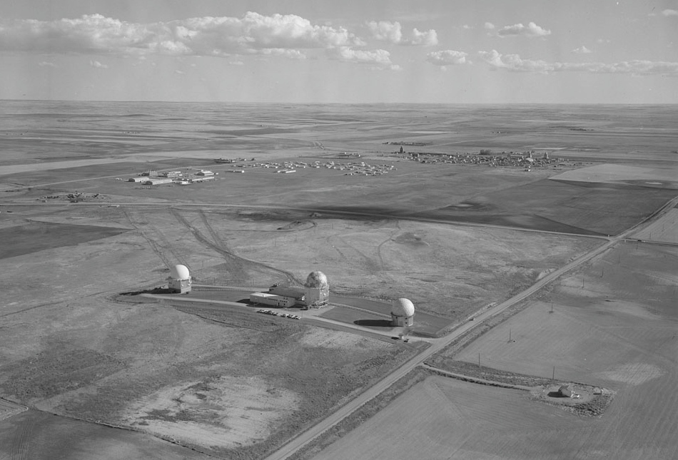
Built just north of the small village of Alsask, on the Saskatchewan side of the border, CFS Alsask was a military radar station part of NORAD. Originally named Royal Canadian Air Force (RCAF) Alsask, the construction of the site began in 1961 and was completed on 1 November 1962. Although the station was established and had begun to employ military personnel, it became officially operational within NORAD’s Pinetree Line in May 1963, right when three radar domes (radomes) were installed north of the barracks, the FPS-107 Search, FPS-26 Height Finder, and the FPS-6X Height Finder. In May 1967, RCAF Alsask was renamed to CFS Alsask due to the unification of the Canadian Armed Forces and remained named as such until its closure in 1987.
The radomes at CFS Alsask were some of the last commissioned and constructed along the Pinetree Line, having been configured to close the gap of radar surveillance that remained uncovered in the Canadian prairies. The radomes housed cutting-edge technology imperative to the implementation of NORAD’s Semi-Automatic Ground Environment (SAGE) system, which allowed for both the United States and Canada to automatically detect a hostile bomber approaching from any direction. Not only did the Alsask Radars considerably aid aerial defence, but they helped pioneer the advancement of modern automated air defence systems utilised today.
Crucial though the technological aspects of CFS Alsask were to the function of NORAD, Lieutenant-Colonel LA Gibbon wrote in 1978 that these statistics served only as a fragment of the story. He claimed that CFS Alsask was more than merely a radar station, but rather a “living organism” (Gibbon, 1978/1981).
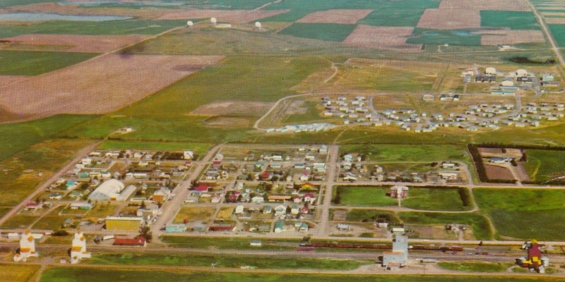
Recall, the station sat next to the village of Alsask, a small community of no more than 200 people. Located 3.5 hours from Calgary, Alberta, nearly 3 hours from Saskatoon, Saskatchewan, and in the heart of Palliser’s Triangle, Alsask was isolated in barren terrain. Over three decades since the village’s establishment in 1911, it had become increasingly more decrepit. Not only did the sub-marginal agricultural landscape prove difficult to cultivate, but the drought and depression of the 1930s resulted in a massive economic decline from which the village could not overcome. However, the establishment of CFS Alsask gave the village an opportunity for revival.
Since the staff at CFS Alsask were isolated from shopping, sporting, and recreational centres found in big cities, they began to rely on the village of Alsask as much as they did themselves to create an enjoyable lifestyle while on tour at the station. For instance, civilians provided the staff with services such as banking, postal, water supply, and shopping opportunities, among many others. Business began to thrive and the village’s inhabitants, many of whom were founding members, saw new life given to their home. CFS Alsask’s revitalization of the village was not one-sided, rather mutually beneficial. The residents of Alsask were able to give the soldiers and their families solace and support, as they understood the difficulties of rural isolation that many of these newcomers were unfamiliar with and struggled adjusting to.
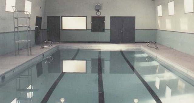
The reciprocity between the station and village allowed for the two groups to cooperatively succeed in ways only achievable together. For example, on 16 November 1968 the punily named Gopher Dip Pool (Go-for-a-dip Pool) was constructed and opened, having provided indoor swimming all year round for station soldiers and residents of Alsask alike. Similar to the pool, a golf course and ski hill were built for recreational use by both groups.
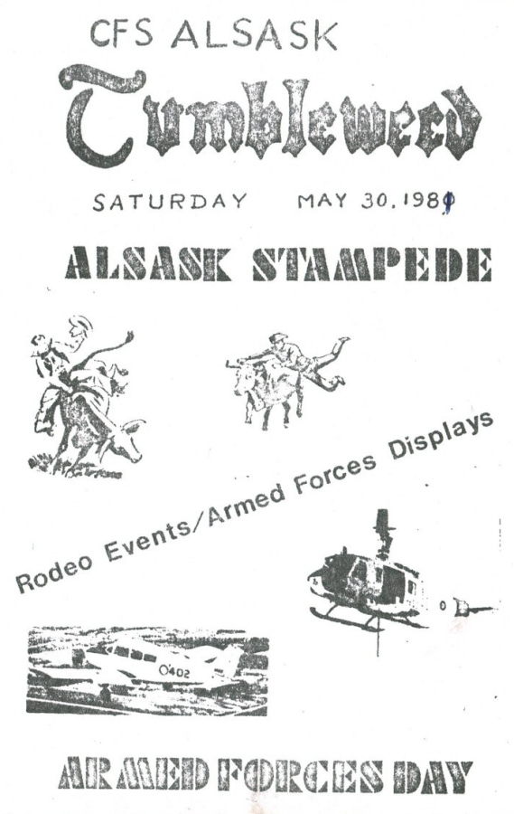
In addition to the development of physical facilities, various annual events were created which united the soldiers and their families with Alsask’s residents. One of the most popular gatherings was the Alsask Stampede, a professional rodeo celebrated on the first Sunday in June. Other events included the Winter Carnival which would take place over four days in late February. Themed with snow sculptures, mascots, an opening parade, and multiple team games including log sawing, beard growing, and tea making, the Winter Carnival was an event to ease the coming of the harsh winter weather. Even within the village of Alsask itself, residents invited the soldiers to participate in their clubs, whether it was curling or skating or even helping local farmers with seeding. Additionally, a local paper was created, The Tumbleweed, and was published every month (except for July and August) informing readers with news about the station and the village.
Over 20 years, CFS Alsask and the village of Alsask were a joint community, each supporting the other. On 1 August 1987, CFS Alsask was disbanded and closed as the Pinetree Line was slowly becoming decommissioned. Although some of the buildings were demolished, much of the station remained untouched. The barracks were converted into residential homes and sold to individuals. The village took over the Gopher Dip Pool and the recreation centre, still using its facilities today, including the full-sized gymnasium and bowling alley for weekly clubs. As for the radomes, only the FPS-107 remained intact, currently owned by the Civil Defence Museum who offer tours of the building.
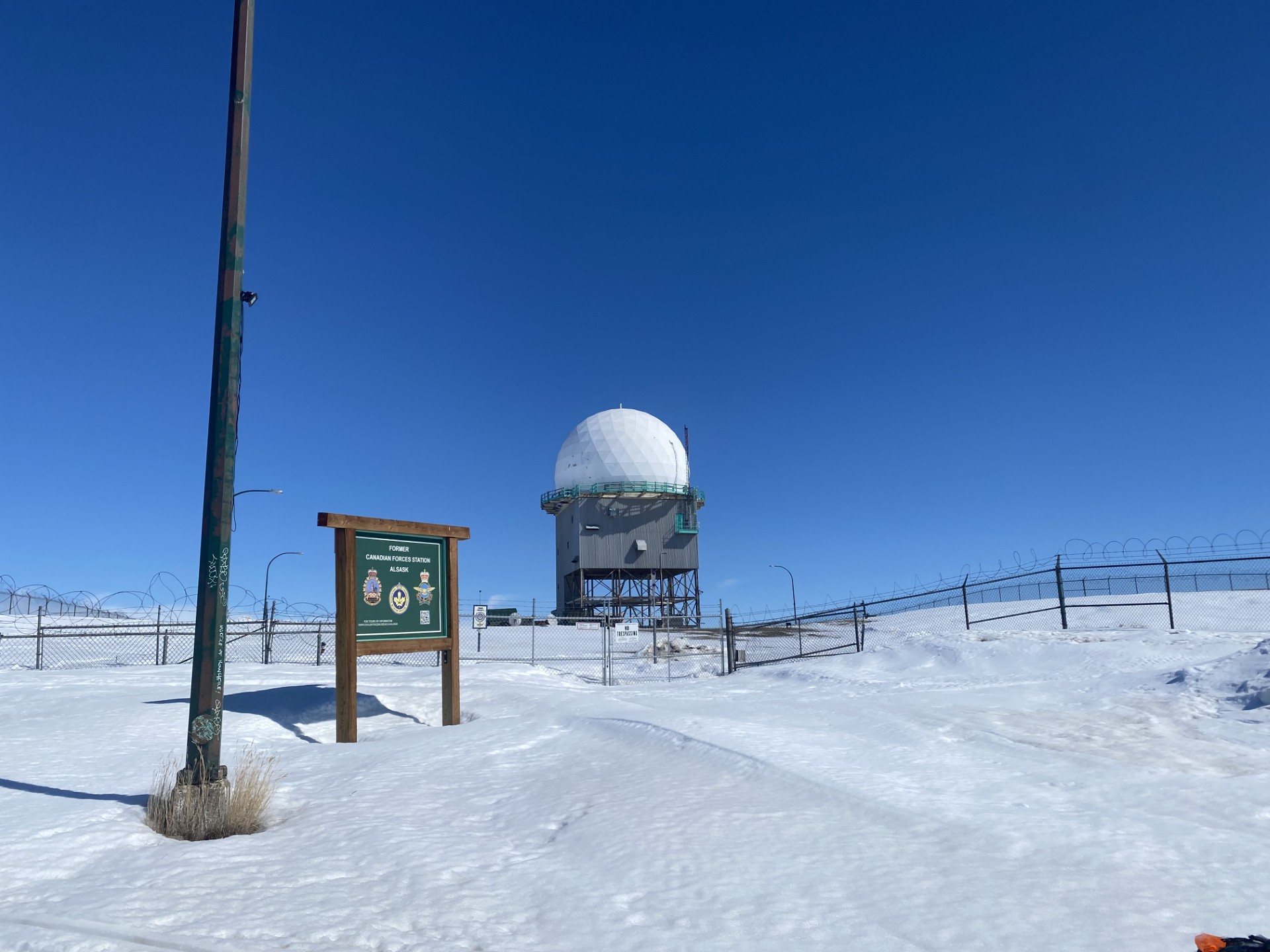
CFS Alsask represents only one of the many abandoned and forgotten military stations in Canada. Despite its short span of life, the legacy of CFS Alsask, its influence on NORAD and Canada’s Cold War efforts, as well as on the village of Alsask, remains alive today. From the flat plains of Saskatchewan, the golf ball-shaped radome can still be seen piercing through the horizon, reminding those driving on Highway #7 and Highway #44 of its profound impact.
Main photo: Aerial view of Pinetree radar station at Alsask. (Includes the barracks and operations as well as the village of Alsask in the distance.) (Credit: Library and Archives Canada #5033296)
Sources:
Boileau, John. “Unification of the Canadian Armed Forces.” The Canadian Encyclopedia, 2021. https://thecanadianencyclopedia.ca/en/article/unification-of-the-canadian-armed-forces
Bonikowsky, Laura Neilson. “Drought in Palliser’s Triangle.” The Canadian Encyclopedia, 2015. https://thecanadianencyclopedia.ca/en/article/drought-in-pallisers-triangle-feature
Canada’s Historic Places. “Alsask Radar Dome.” Parks Canada, n.a. HistoricPlaces.ca – HistoricPlaces.ca
Gibbon, LA. “1981 – Radar Reflections.” C&E Newsletter, 1978/1981. http://c-and-e-museum.org/Pinetreeline/other/other1/other1b.html
Herd, Alex, and John Boileau. “Canada and the Cold War.” The Canadian Encyclopedia, 2026. https://thecanadianencyclopedia.ca/en/article/cold-war
“RCAF/CFS Alsask.” Civil Defence Museum, n.a. https://civildefencemuseum.ca/alsask
“RCAF Station Alsask.” RCAF Info, n.a. https://rcaf.info/rcaf-stations/saskatchewan-rcaf-stations/rcaf-station-alsask-radar/
Simpson, Sarah. “Military Radomes.” Defense Advancement, 2026. https://www.defenseadvancement.com/suppliers/radomes/
University of Regina. “Air Defence Stations.” The Encyclopedia of Saskatchewan, n.a. https://www.esask.uregina.ca/entry/air_defence_stations.html